
A new map tracking most utility-scale solar power plants has been developed from government project databases. The map, called the U.S. Large-Scale Solar Photovoltaic Database (USPVDB), tracks ground-mounted, front-of-the-meter, 1 MW direct current sized or larger-sized projects.
The map was developed by individuals within the U.S. Geological Survey (USGS) Energy Resources Program along with Lawrence Berkeley National Laboratory (LBNL) Energy Markets and Policy Department. Funding came from the U.S. Department of Energy (DOE) Solar Energy Technologies Office and USGS Energy Resources Program.
While much of this information has already existed in various government databases, the USPVDB augments that data with complementary information on the total footprint area and detailed attributes of each facility, including panel technology type, axis type, year of installation, and generation capacity.
Project site information was also added – whether it is a greenfield, or has previous, current, or suspected contamination, or if agrivoltaic. The projects were position-verified and digitized by aerial imagery, and checked for quality to verify facility locations.
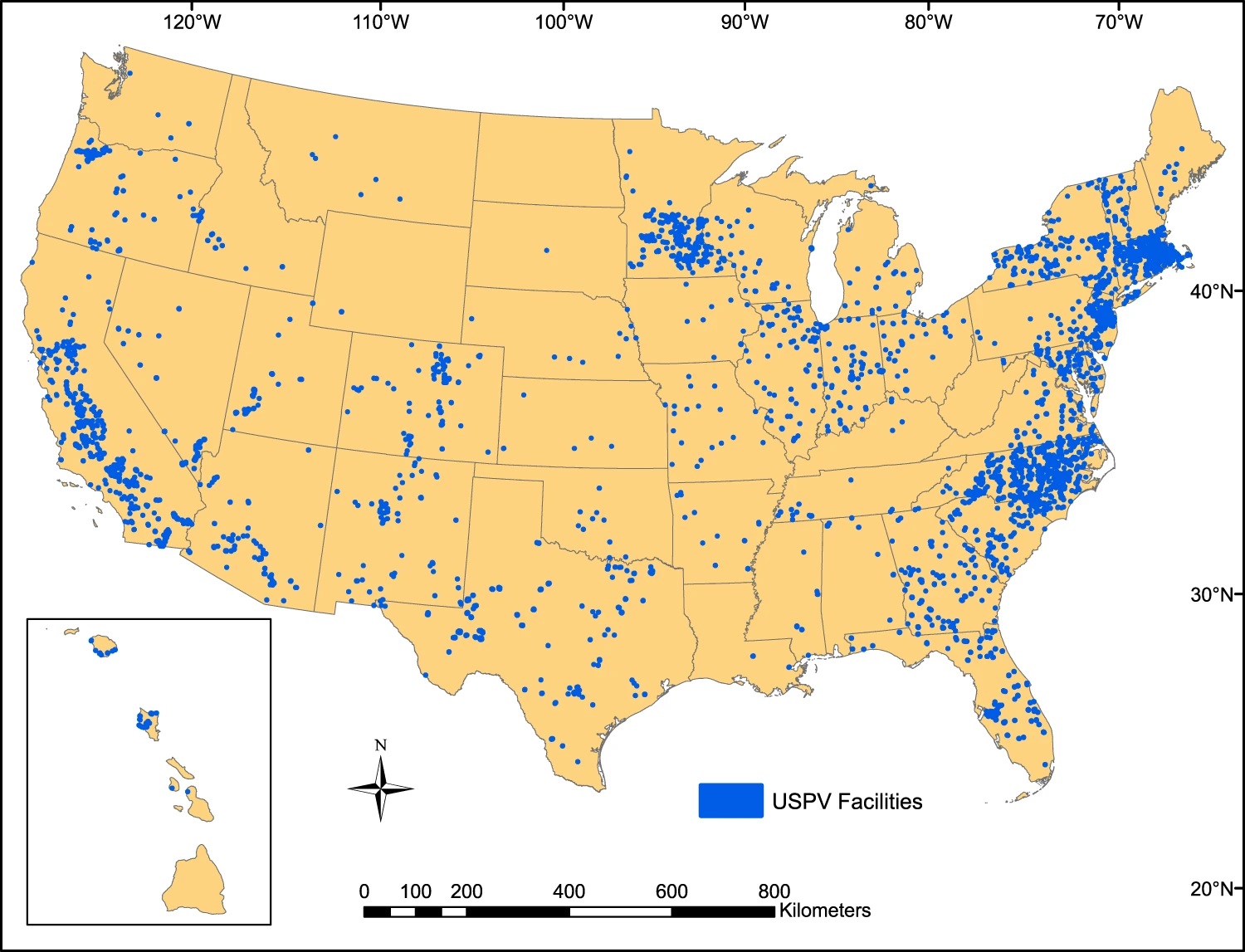
The map viewer shows 3,676 total solar facilities representing 54,880 MWac of generating capacity that was online before 2022. Data from the resulting process is available for public use and is provided in multiple formats – ESRI shapefile, GeoJSON file, CSV, and XML.
The resource is being made available to researchers, as well as being used to inform decision makers within the DOE and the President’s offices. The DOE said ground-mounted solar could require 5.7 million acres by 2035, and 10 million acres by 2050. Thus, the administration was seeking tools to help mitigate the impacts on the environment when siting solar power facilities.
The U.S. Bureau of Land Management put up for consideration land that could host 5.3 GW of solar, as part of the nation’s goal of 25 GWs by 2025 on public lands.
In addition to the map and data released, the groups also published a research paper – Georectified polygon database of ground-mounted large-scale solar photovoltaic sites in the United States – on the subject, sharing how they did their work to develop this tool.
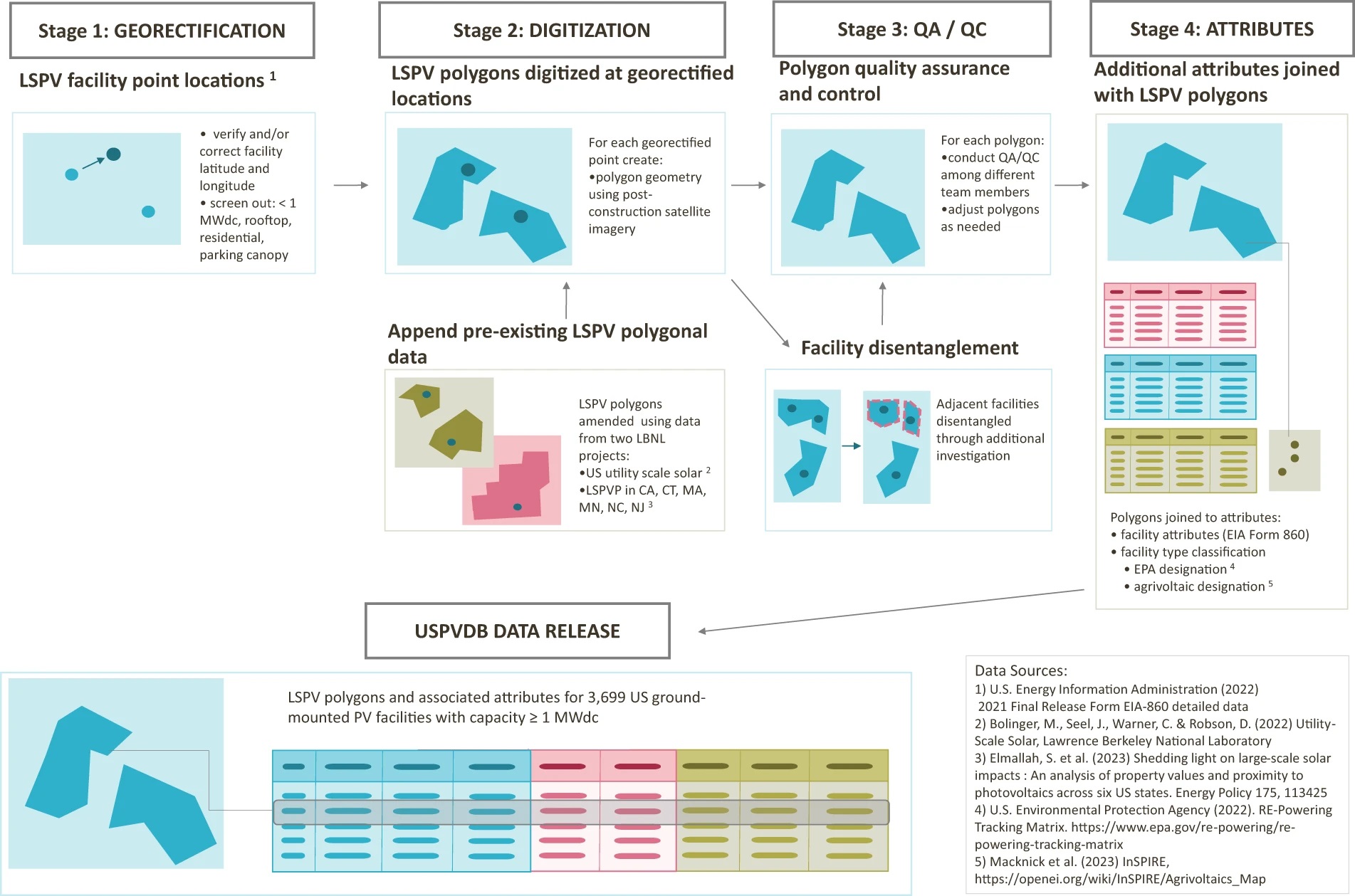
The basics of the process that the researchers went through to develop the database are described above. Work began by first ‘georectifying’ facility coordinates by finding the sites via latitude and longitude data provided by the DOE’s Energy Information Administration (EIA), then to visually verify using high-resolution aerial imagery. Next, using the georectified coordinates, polygons were manually drawn around the extent of panel arrays and inverters by USGS and LBNL analysts using ArcGIS software. Last, the team appended existing data within information from other databases.
This content is protected by copyright and may not be reused. If you want to cooperate with us and would like to reuse some of our content, please contact: editors@pv-magazine.com.


Hey, just like the wind database. Love those filters. Thanks, John.