The Connecticut Department of Energy and Environmental Protection (DEEP) announced it has launched a new online tool for large-scale solar project siting in the state.
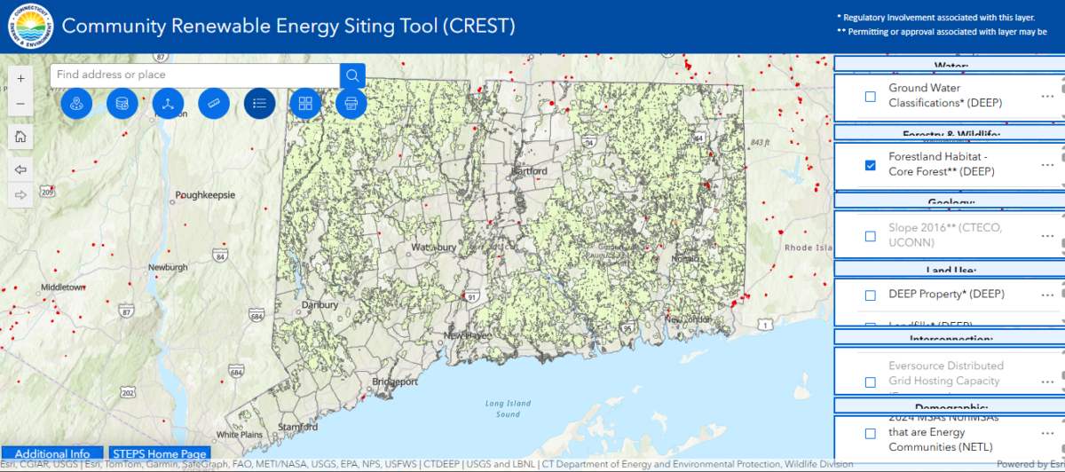
The tool allows users to apply filters to a map to see if a given project site is located on or near critical protected habitats, view grid hosting capacity data, soil types, ground slope, forest cover and more.
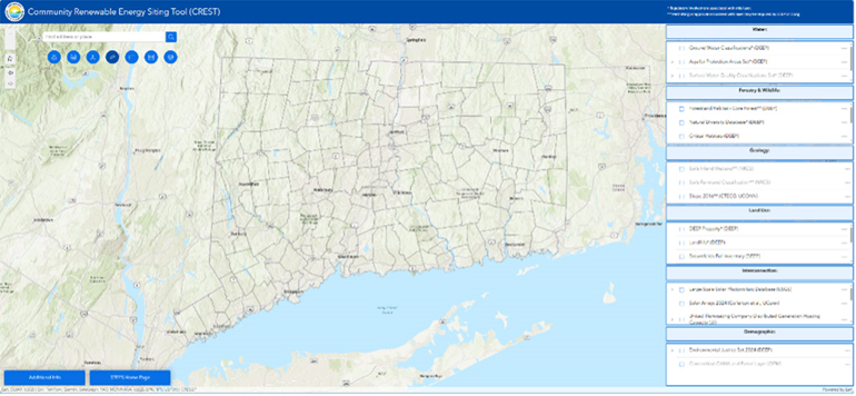
The map tool, called Community Renewable Energy Siting Tool (CREST), uses Geographic Information Systems (GIS) mapping to display data in an easy-access format. It is free to the public and does not require specialized GIS software, said DEEP.
DEEP said the tool “will enable a more transparent and efficient siting and permitting process” for large-scale renewable energy projects while protecting Connecticut’s environmental and natural resources. Connecticut is the fourth most densely populated state, highlighting a need to site solar projects in a way that is sensitive to other community needs for land uses, said DEEP.
Connecticut Public Act 24-31 mandated DEEP to create an online map by May 2025 to support the “potential siting of solar projects in the state.”
The map tool was developed in partnership with University of Connecticut’s Center for Land Use Education and Research (UConn CLEAR). UConn CLEAR is hosting a webinar with DEEP on June 18th at 1:00 p.m. to demonstrate how to use CREST.
“Large-scale renewable energy projects are an important component of our strategy to meet our energy supply needs, make electricity more affordable for residents, and continue progress toward the state’s target of a 100% zero carbon electric supply by 2040,” said DEEP Commissioner Katie Dykes. “This new tool will inform the siting process and also provide greater transparency to the public.”
DEEP also has resources providing guidance on siting solar projects on brownfields and on agricultural lands. The map tool and guidance were developed via a stakeholder engagement process called Sustainable, Transparent and Efficient Practices for Solar Development (STEPs).
This content is protected by copyright and may not be reused. If you want to cooperate with us and would like to reuse some of our content, please contact: editors@pv-magazine.com.


To promote efficiency & synergy, shouldn’t this mapping tool highlight all the existing large hot asphalt parking lots in the state, where solar canopies +stationary batteries +Vehicle-2-Grid chargers could rapidly deploy a reliable matrix of widely distributed community micro grids, right where most people live & work. No new utility transmission, site acquisition, or other site improvement spending required. Remote solar farms that require a transmission inter-connection don’t do that.