From pv magazine Global
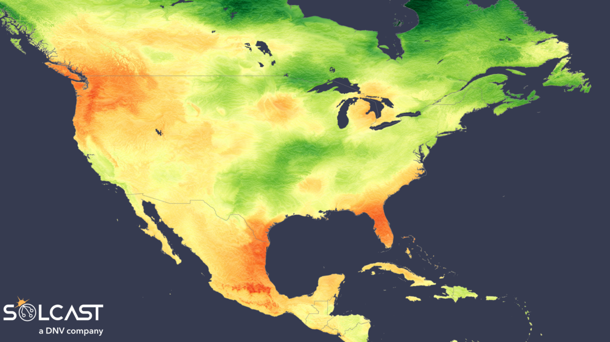
A strong jet stream and Eastern storms have split solar conditions across the U.S. According to analysis using the Solcast API, solar conditions were significantly depressed across the Eastern U.S. due to persistent storm activity, while the northwest saw clear skies and irradiance gains alongside unseasonably cool temperatures.
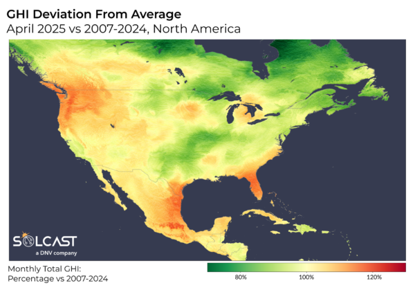
In the Eastern U.S., a high pressure system over the Atlantic drove warm, humid air from the Gulf and Atlantic into the Southeast. This moist inflow, trapped between the coast and the Rockies, fueled widespread cloud cover and elevated rainfall, with temperatures also running above average. As a result, irradiance dropped by up to 20% below the long-term April average from New England to Oklahoma.
These conditions were further intensified by a strengthened jet stream cutting across the South, injecting additional energy into the atmosphere. This setup triggered repeated rounds of severe storms and tornado outbreaks, compounding the cloudiness and further reducing solar generation potential across multiple regions.
Florida, however, was a notable outlier. While much of the southeast contended with persistent cloud cover and storm systems, the state saw relatively dry and sunny conditions. This can be attributed to the position of the high-pressure system. The ridge of higher than usual pressure extended across Florida and promoted more settled weather. As a result, the state experienced reduced rainfall and clearer skies, diverging sharply from the wetter, cloudier pattern affecting its neighboring states.

By contrast, the northwestern states benefited from more stable conditions. A high-pressure system situated over the Pacific suppressed cloud formation west of the Rockies, particularly across Washington and Oregon. Dry air from Canada contributed to clearer skies and allowed more overnight cooling in the absence of blanketing clouds. Surface temperatures down to 39.2 F below the long-term average for April were good for efficient solar panel performance, while irradiance levels climbed by more than 15% in the Northwest compared to the long-term average, providing favorable conditions for solar operators in the region.
Solcast produces these figures by tracking clouds and aerosols at 1-2km resolution globally, using satellite data and proprietary AI/ML algorithms. This data is used to drive irradiance models, enabling Solcast to calculate irradiance at high resolution, with typical bias of less than 2%, and also cloud-tracking forecasts. This data is used by more than 350 companies managing over 300 GW of solar assets globally.
The views and opinions expressed in this article are the author’s own, and do not necessarily reflect those held by pv magazine.
This content is protected by copyright and may not be reused. If you want to cooperate with us and would like to reuse some of our content, please contact: editors@pv-magazine.com.


By submitting this form you agree to pv magazine using your data for the purposes of publishing your comment.
Your personal data will only be disclosed or otherwise transmitted to third parties for the purposes of spam filtering or if this is necessary for technical maintenance of the website. Any other transfer to third parties will not take place unless this is justified on the basis of applicable data protection regulations or if pv magazine is legally obliged to do so.
You may revoke this consent at any time with effect for the future, in which case your personal data will be deleted immediately. Otherwise, your data will be deleted if pv magazine has processed your request or the purpose of data storage is fulfilled.
Further information on data privacy can be found in our Data Protection Policy.