Raptor Maps is taking an innovative approach to solar monitoring technology. The company is developing solar-specific software tools that, when combined with their groundbreaking “drone in a box” platform, will offer solar power facilities a permanent digital and thermal scanning presence on site.
Raptor and Skydio declined to provide pv magazine USA with explicit product specifications; however, a rough estimate suggests that this hardware package could cost mere thousandths of a cent per kilowatt-hour.
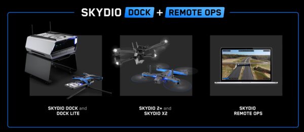
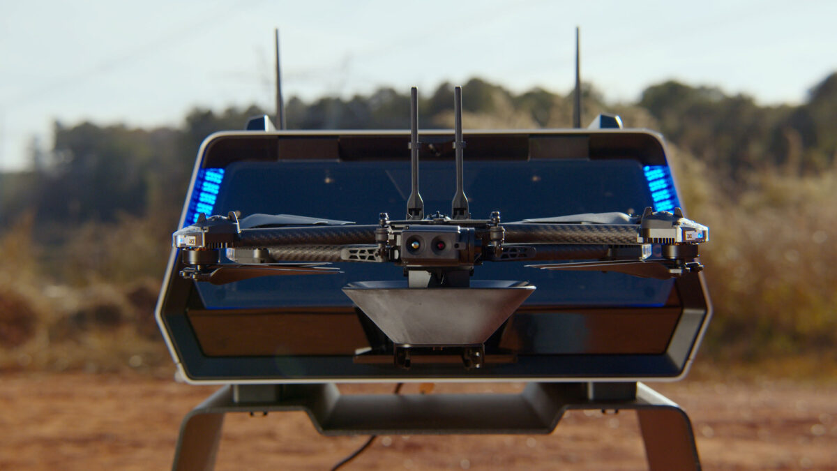
Raptor Maps announced that they are partnering with Skydio in the development of the Skydio Dock. This dock is set to be smaller and lighter than the $30,000 DJI Dock from a competing drone company. Skydio offers two versions of its hardware: the $1,100 S+ drone and the X2 Autonomous Drone, which includes a thermal camera and costs approximately $15,000 per unit. The X2 boasts a range of 6 to 10 km, depending on bandwidth, and can fly for 35 minutes per charge.
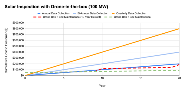
Raptor Maps released an infographic that suggests a starting price of approximately $50,000 for their system, with a projected ten-year lifetime. The graph increases from $50,000 to $100,000 over the course of 20 years, indicating that the service package that Raptor Maps sells along with the drone in a box will cost $2,500 annually.
If we consider a 100 MW solar power plant that generates an average of 161.5 GWh of electricity per year for the first decade, the levelized cost of electricity would increase by only three thousands of a cent due to the implementation of this unit (service price not included).
If the unit were to be permanently installed onsite, it is likely that it could qualify for the 30% Inflation Reduction Act tax credit.
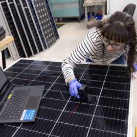
According to Raptor Maps, the primary use of drones in the utility-scale solar industry is to scan for thermal anomalies. To facilitate this, the company provides a software suite that enables facility operators to make informed technical decisions based on a wealth of data.
Raptor Maps emphasizes the numerous benefits of their system, which include quarterly module inspections, substation and overhead line inspections, and reactive inspections. Additionally, the technology allows for monitoring of vegetation, fencing, civil works, and general security, ensuring comprehensive oversight of solar facilities.
This content is protected by copyright and may not be reused. If you want to cooperate with us and would like to reuse some of our content, please contact: editors@pv-magazine.com.

By submitting this form you agree to pv magazine using your data for the purposes of publishing your comment.
Your personal data will only be disclosed or otherwise transmitted to third parties for the purposes of spam filtering or if this is necessary for technical maintenance of the website. Any other transfer to third parties will not take place unless this is justified on the basis of applicable data protection regulations or if pv magazine is legally obliged to do so.
You may revoke this consent at any time with effect for the future, in which case your personal data will be deleted immediately. Otherwise, your data will be deleted if pv magazine has processed your request or the purpose of data storage is fulfilled.
Further information on data privacy can be found in our Data Protection Policy.