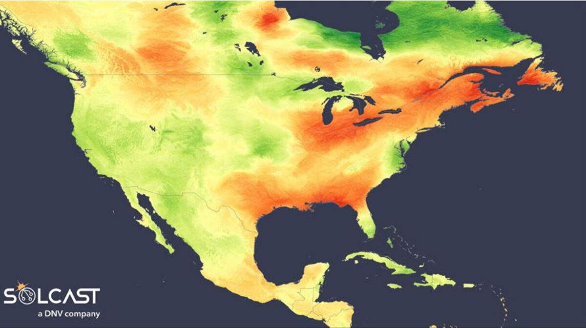
Frontal systems, widespread wildfires and an omega block pattern contributed to highly mixed irradiance anomalies across North America in September, according to analysis using the Solcast API. Solar conditions underperformed in much of the West and Midwest, while the Northeast, South, and parts of Canada recorded a strong month. Aerosols, storm debris, and persistent cloud were the primary drivers of reduced irradiance in the western states, while stagnant high pressure delivered favourable conditions in parts of Canada and the eastern U.S.
![]()
From California through to the central plains, September irradiance fell between 10% and 20% below climatological norms. This marked a departure from seasonal expectations, particularly in the West, where late-summer conditions typically bring stable, clear skies. Instead, recurring frontal systems resulted in increased cloud cover, especially earlier in the month. Tropical Storm Mario, which brought moisture and instability to the region, was a notable contributor to the suppressed solar performance.
Wildfire aerosols—most notably from Canada—also played a role. In the Pacific Northwest, reductions in clear-sky irradiance reached up to 10%, with residual smoke and particulate matter limiting irradiance. Sea spray and storm debris along the coast further compounded the clouding effects.
![]()
However, despite a negative aerosol impact, a zone stretching east of Vancouver, including Alberta, Saskatchewan and Montana bucked the broader western trend. Here, irradiance levels were around 10% above the September average. A blocking high-pressure system, referred to as an omega block, developed, stabilising atmospheric conditions and clearing skies. While wildfire smoke was still present, the dry, subsiding air associated with the high-pressure limited cloud formation, allowing irradiance levels to climb despite aerosol presence.
From the Great Lakes to the Southeastern U.S. and into coastal Quebec, irradiance anomalies reached as high as 30% above climatology. While storm systems were still frequent, the omega block’s influence had effectively driven oceanic moisture offshore, promoting more stable and sunnier conditions overall. This led to a marked increase in irradiance across a broad swathe of the United States, from Texas to New England.
Looking ahead, the seasonal outlook for the remainder of autumn suggests continuity in the current pattern. Analysis of forecast anomalies indicates irradiance levels 15% to 20% above normal across much of the eastern seaboard. Western regions, from Washington to California and extending inland to Utah and Oklahoma, are projected to remain 10% to 15% below seasonal averages. A zone of positive irradiance anomaly—approximately 10% above average—is forecast to persist from Western Canada into the Mountain West.
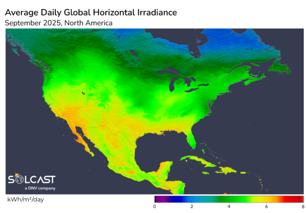
Solcast produces these figures by tracking clouds and aerosols at 1-2km resolution globally, using satellite data and proprietary AI/ML algorithms. This data is used to drive irradiance models, enabling Solcast to calculate irradiance at high resolution, with typical bias of less than 2%, and also cloud-tracking forecasts. This data is used by more than 350 companies managing over 300 GW of solar assets globally.
The views and opinions expressed in this article are the author’s own, and do not necessarily reflect those held by pv magazine.
This content is protected by copyright and may not be reused. If you want to cooperate with us and would like to reuse some of our content, please contact: editors@pv-magazine.com.


By submitting this form you agree to pv magazine using your data for the purposes of publishing your comment.
Your personal data will only be disclosed or otherwise transmitted to third parties for the purposes of spam filtering or if this is necessary for technical maintenance of the website. Any other transfer to third parties will not take place unless this is justified on the basis of applicable data protection regulations or if pv magazine is legally obliged to do so.
You may revoke this consent at any time with effect for the future, in which case your personal data will be deleted immediately. Otherwise, your data will be deleted if pv magazine has processed your request or the purpose of data storage is fulfilled.
Further information on data privacy can be found in our Data Protection Policy.