Cypress Creek Renewables is moving a 10 MW-AC, 14 MW-DC, single axis tracker solar power plant through the processes in Columbia, Missouri. On Thursday, August 23 local government held a public meeting on the 94 acre plot (Meeting Agenda PDF), 70 of which will be ‘disturbed’ and 57 of which will be the ‘preliminary solar area.’ In the end, the project was allowed to move forward – though opinions differ on whether they should have.
The project will have approximately 440,000 modules, with the electricity being sold to Columbia Water & Light at $44.81/MWh in a 30 year contract. Water and Light is also planning to build a $1.4 million extension from its Rebel Hill substation to the “Truman Solar” project. The solar facility is scheduled to be operational by April 1, 2019.
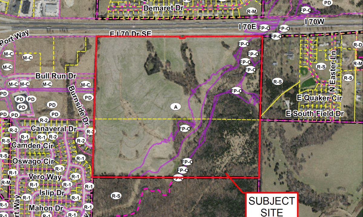
Extracted from the city’s official Locator Map (PDF):
In the above noted Meeting Agenda (PDF), were a list of Public Comments (PDF) put forth by neighboring landowner Tim Wait. They were the most elucidating of the stresses potentially put on those around them by solar power development, and how developers work to alleviate these challenges. Among the specific issues noted by Waid (but not all of his comments) –
- Issue 1: Impervious Surface of Solar Farm and Catchment Technologies under each Solar Panel
- Issue 2: Storm Water Runoff of Solar Farm into neighboring parcel
- Issue 3: Landscaping Needs to be designed into the Solar Farm perimeter
The public comment document did list responses from Cypress Creek and local municipalities. More important though were the additional development engineering documents included – starting with the PD Plan, dated 8/17/18 (PDF).
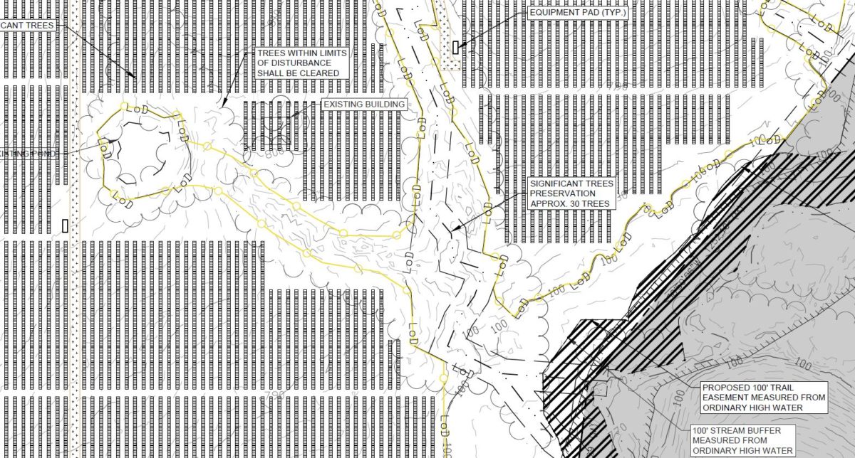
In particular focus for this article, as neighbor Waid noted it was the greatest of his stresses, were the protection of the “significant trees”, neighboring land, the nearby Missouri river, through proper water runoff management.
The below image extracted from the PD Plan, on page Z 3.0 – which is 3 of 6 in the PDF. It’s a drawing of a chunk of solar panels and how the design moves around the “significant trees”. Note the below image matches the tree map further down.
In a separate document, the Tree Preservation Appendix (PDF), we see a literal list of significant trees within the Tree Preservation area. The trees are catalogued by image, height, and species – and placed on a very well measured topographic map.
Other documents within the multiple packages specify requirements for security fencing, fencing designs, setbacks from heavily preserved areas, setbacks from the main street, etc.
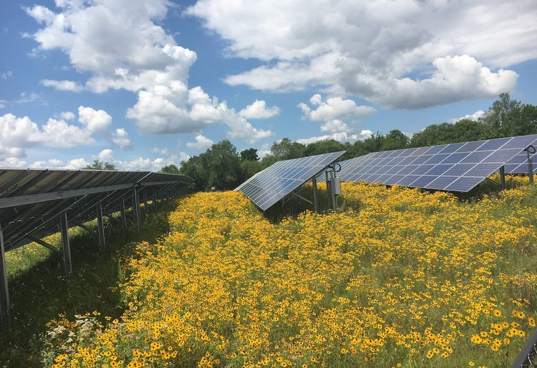
In other sites the company has taken to designing pollinator friendly vegetation along with the solar.
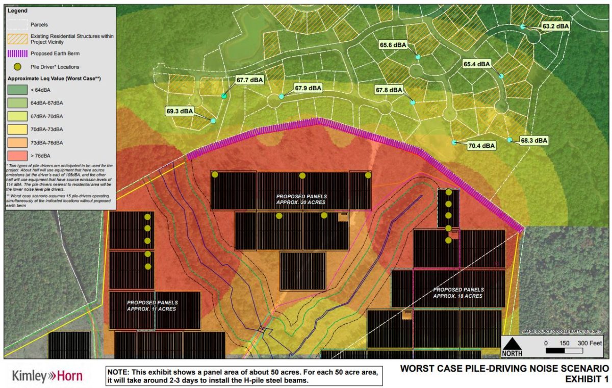
As solar power has expanded, and the amounts of land it takes up are becoming more considerable in the minds of the populace – the quality of the work surrounding these large scale plants must continually increase. It won’t be enough in the future to simply say that solar offsets pollution – holistic integration is a must. Prior projects that we’ve covered have shown other innovative ways of showing how their work will affect those around them – such as sPower’s ‘worse case pile-driving noise scenario’ analysis in Virginia.
Edit – The project was initially listed as 140 MW, but is actually a 140 acre piece of land.
This content is protected by copyright and may not be reused. If you want to cooperate with us and would like to reuse some of our content, please contact: editors@pv-magazine.com.




Seems like somebody didn’t do their homework on this article … kind of hard to build a 140 MW solar facility with only 44,000 panels on less than 94 acres! The project is only 10 MW in size per the County’s documents.
I saw that 10MW notation as well while doing the research for it this morning, and that might have been true a long time ago in an original proposal, but all of the current design work that was submitted at the public meeting agenda this past Thursday definitely points to 140 megawatt plant.
Good catch! On average it takes about 2.5 acres per 1 MW capacity. So 94 acres would support about 38 MW capacity. 10 MW capacity maybe takes 25 to 30 acres with landscaping screening, tree retention and rainwater runoff collection. (Panels don’t really cover the ground since they’re elevated and water can drain underneath them)
Also 44,000 panels at 230W each comes to about 10 MW capacity.
Could 140 MW be the expected annual production? Maybe planning an expansion? My best guess is that in a year this 10MW capacity array will produce about 17,500 – 18,000 MWh of electricity. Guessing 20% capacity factor in Missouri?
So I think you’re right, the 140 value is not AC, but acres.
Thanks for the response, John … now that I look into further I note that it is not a county but a city that approved the permit. Could be the 10 MW is only the part under the city’s jurisdiction and the balance of the project has been or will be permitted separately. Still kind of confusing with the numbers not adding up though.
Isn’t there someone on the Building Department that you could call and ask?
Besides, only partially ‘impervious’. Perhaps they could recycle some of the fallen water for cleaning the panels..
Its a 10 MW AC project and 14 MW DC. I think that the numbers reported int he first version of this article were incorrect. I work for CCR and know that I would have heard about a 140 MW project in Missouri!
Thank you!