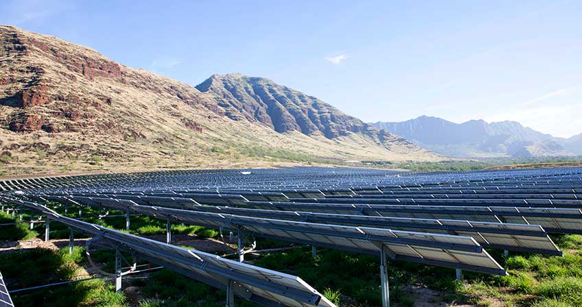
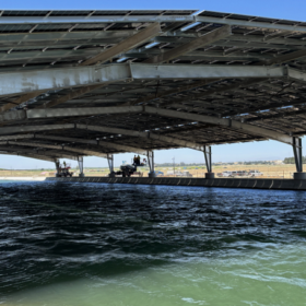
A common obstacle in the siting and construction of solar projects is concern around land use. Certain regions, especially islands, which are limited in land area, can’t afford to trade-off prime agricultural land for solar facilities.
This issue has come to a head in Hawaii’s Oahu, an island particularly constrained in land use with declared goals to double local food production by 2030 and produce 100% of the its electricity with renewable energy by 2045.
In an attempt to create an optimal pathway for achieving both of those goals, Dr. Matthias Fripp, associate professor of electrical engineering at the University of Hawaii at Manoa, released a white paper outlining what different land use scenarios would mean for the island in terms of land availability, total electric generation costs, and the overall design of the electric system on Oahu.

Fripp’s models are founded on an electricity system planning model called Solar and Wind Energy Integrated with Transmission and Conventional Sources (SWITCH).
The land-use assumptions modeled by SWITCH include more restrictive use of the Land Study Bureau Class B and Class C agricultural lands, and higher slope limits for potential solar PV project sites. Class B and C lands are determined based on the findings of an inventory and evaluation of the state’s land between 1965 and 1972, undertaken by the Land Study Bureau of the University of Hawai‘i. Land is graded anywhere from A to E, with A representing the highest class of productivity and E the lowest, based on a variety of factors.
The analysis revealed that the use of some agricultural lands for solar results in lower costs for Hawaiian Electric Company and its customers, with a couple of scenarios achieving the protection of O‘ahu’s most productive agricultural lands with negligible impact to customers’ electricity costs.
Potentially the most important variable outlined in the different scenarios regards the slope of land that PV can reasonably be constructed on.
When all Class B and C lands with <15% slope are made available for solar development, SWITCH estimates roughly 51% of Class B agricultural lands would likely be selected, while around 16% of Class C agricultural lands would likely be selected, though this scenario would likely face pushback from farmers and agricultural advocates.
Upping the slope to <20% while still keeping all Class B and C lands open for development would likely result in 49% of Class B agricultural selected and roughly 15% of Class C agricultural chosen.
The study found that if developers are willing to construct projects on higher-sloped lands, regardless of the agricultural land-class limit, the result is a lower-cost resource plan for both utility and consumer. This is true despite potential increases in individual solar project development costs.
The model shows these increases in development costs as manageable, with the average cost per kWh rising just 0.6 cents when the slope of lands considered rises from <15% to <20%.
The total lowest-cost energy resource plan is achieved when there is no limitation on the use of Class B and C agricultural lands, and solar developers are willing to build on sites with up to 20% slope, while restrictive limits of the use of Class B and C agricultural lands would require the island to quickly transition to other renewable resources, like offshore wind and biofuels, all of which are currently more expensive to develop than PV.
This content is protected by copyright and may not be reused. If you want to cooperate with us and would like to reuse some of our content, please contact: editors@pv-magazine.com.


Before one goes on a journey one needs yo know where it is and what resources are needed…. not a single word defines the problem…
• How much MW of Power does Ohau, etc.. need.. 100MW, 1000MW, 10,000MW etc… or GWhrs/yr etc… preferably the latter…
• Once you know your goal (at whatever time in the future as it WILL TAKE TIME to install a ZEO POLLUTION ENERGY SYSTEM.. you can then develop a plan..an option.. etc….
(Researching various “types of land” without even knowing what you need.. is going to end up nowehere… like here…).
PLEASE DEFINE WHAT IS NEEDED AND BY WHEN… FIRST… PLEASE…